


Loges-Marg-03_14

DomifaC
User
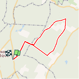

Length
13.8 km

Max alt
188 m

Uphill gradient
144 m
Km-Effort
15.7 km

Min alt
141 m

Downhill gradient
143 m
Boucle
Yes
Creation date :
2019-04-29 12:38:03.372
Updated on :
2019-04-29 12:38:03.402
3h05
Difficulty : Easy

FREE GPS app for hiking
 SityTrail
IGN / Geographical institutes
SityTrail Plus
The world is yours!
About
Trail Nordic walking of 13.8 km to be discovered at Grand Est, Aube, Les Loges-Margueron. This trail is proposed by DomifaC.
Positioning
Country:
France
Region :
Grand Est
Department/Province :
Aube
Municipality :
Les Loges-Margueron
Location:
Unknown
Start:(Dec)
Start:(UTM)
583572 ; 5328341 (31U) N.
Comments